Desertcart purchases this item on your behalf and handles shipping, customs, and support to South Africa.
🧭 Float, find, and fearlessly explore with Garmin GPSMAP 78s — your ultimate navigation sidekick!
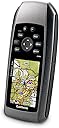
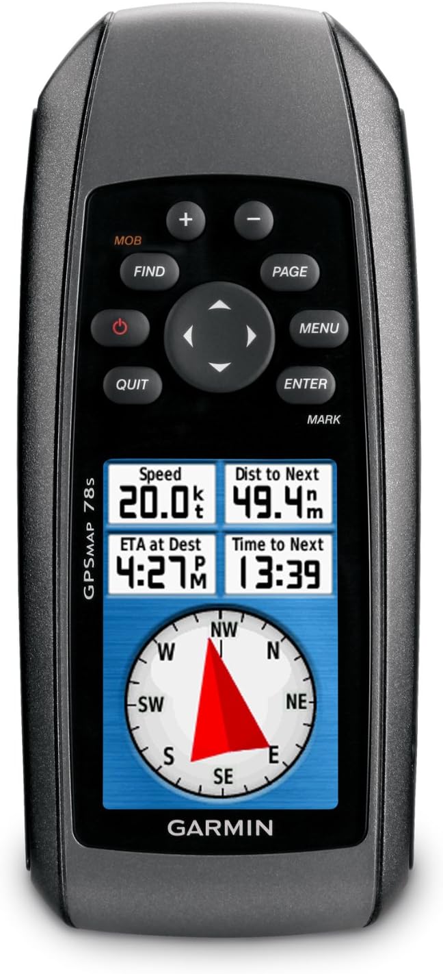
The Garmin GPSMAP 78s is a rugged, waterproof handheld GPS device featuring a 3-axis compass, barometric altimeter, and built-in worldwide basemap. Designed for marine and outdoor use, it offers high-sensitivity WAAS-enabled GPS with quick satellite fixes, wireless sharing of waypoints, and expandable map storage via microSD. Its IPX7 rating ensures it floats and withstands harsh conditions, making it the perfect tool for precise navigation and adventure.
| ASIN | B003I86PJ6 |
| Are Batteries Included? | No |
| Audio Output Mode | speaker |
| Battery Average Life | 20 Hours |
| Box Contents | Garmin 010-00864-01 Garmin Gpsmap 78S Handheld |
| Brand | Garmin |
| Brand Name | Garmin |
| Compatible Devices | iphone |
| Compatible Flash Memory Type | microSD |
| Compatible with Vehicle Type | Boat |
| Connectivity Protocol | USB Serial (CDC-ACM) |
| Connectivity technology | USB |
| Control Method | Touch |
| Customer Reviews | 4.3 out of 5 stars 489 Reviews |
| Display Type | LCD |
| Global Trade Identification Number | 00753759986773 |
| Human Interface Types | Buttons |
| Item Dimensions L x W x H | 30L x 66W x 152H millimetres |
| Item Type Name | Garmin 010-00864-01 Garmin Gpsmap 78S Handheld |
| Item Weight | 218.3 Grams |
| Manufacturer | Garmin |
| Manufacturer Part Number | 010-00864-01 |
| Map Coverage Type | Africa^Asia^Eastern_Europe^Western_Europe^North_America^South_America^UK,_Ireland_&_Western_Europe |
| Memory Storage Capacity | 1724 MB |
| Model Name | 010-00864-01 |
| Model Number | 010-00864-01 |
| Model Year | 2010 |
| Model name | 010-00864-01 |
| Mounting Type | found in image |
| Network Connectivity Technology | USB |
| Operating Systems | Garmin (système d’exploitation Garmin) |
| Product Features | Area calculation^Auto^Automatic routing^Barometric altimeter^Basemap^Bluetooth^Built-in camera^Electronic compass^Geocaching (GPS stash hunt)^Hunt/fish calendar^Marine (chartplotters, sounders)^Sun & moon information^Tide tables^Touch sensitive screen^Unit-to-unit transfer |
| Product Warranty | The Garmin warranty has a duration of two (2) years as from the date you purchased your Garmin product (after the 1st January 2019). |
| Screen Size | 4 Inches |
| Screen size | 4 Inches |
| Special feature | Area calculation^Auto^Automatic routing^Barometric altimeter^Basemap^Bluetooth^Built-in camera^Electronic compass^Geocaching (GPS stash hunt)^Hunt/fish calendar^Marine (chartplotters, sounders)^Sun & moon information^Tide tables^Touch sensitive screen^Unit-to-unit transfer Special feature Area calculation^Auto^Automatic routing^Barometric altimeter^Basemap^Bluetooth^Built-in camera^Electronic compass^Geocaching (GPS stash hunt)^Hunt/fish calendar^Marine (chartplotters, sounders)^Sun & moon information^Tide tables^Touch sensitive screen^Unit-to-unit transfer See more |
| Sport Type | Fishing |
| Supported Satellite Navigation System | GPS |
| Touch Screen Type | Resistive |
| UPC | 115971002936 617407543087 014891448803 753759121662 097367187581 796793398072 753759100919 753759986773 031112534152 |
| Unit Count | 1.0 count |
| Vehicle service type | Boat |
S**E
Garmin GPSMAP 78s
I purchased this marine gps unit on July 4th 2012 and used it on a trip from Canary Wharf to Harwich and back on an old coal fired steam tug later on that month. I cannot praise it's performance enough being totally accurate at all times and even more useful with the micro SD card containing the Dover to Amsterdam and England Southeast marine chart which I purchased direct from Garmin. It took some time to work through the full instruction manual(downloaded from Garmin)and I had to phone Garmin a couple of times for help which was politely and patiently given. This unit gave great piece of mind during our trip and I would thoroughly recommend it.
I**N
Brilliant
Spot on .. Brilliant bit of kit .. Charts seem expensive and lacking in detail ( Turkey ) .. Uk East Coast chart has far more detail .. Bought as backup to onboard system
S**L
Five Stars
Great addition to my 21footer! Very capable little machine! Everything you need inside plus great portability!
D**O
Good product but slightly complicated menus
I bought this product then added the English Channel sailing map from the Garmin site and I've used the map for various sailing trips in the Solent. I've had no problems with getting a GPS signal and the map has been very accurate. (Lots of other maps are available e.g. for walking.) One or two items on the 78S have been tricky to find in the menu system. I asked for help at the Garmin stand at the boat show and it took three people before getting an answer. Basically even though the screen only shows one option, which is selected by pressing Enter, on some screens pressing Menu can give more options. Simple, but not that obvious when using the 78S. All in all, it's an expensive package but worth the money for piloting in unknown locations and if you don't want to be stuck at the navigation table unaware of what's happening up top.
C**L
Be ware you will need to purchase the charts as well to get the best use out of this!
My parents purchased this for me as my husband and I have just started sailing our own yacht and we needed a handheld plotter as we have no on board electrics. We have never used one of these before so were not sure what to expect. The plotter is useless for marine navigational purposes if you do not buy the Bluechart g2 packs for the area that you are planning on sailing because the basemap is very basic and does not have sufficient information to make it any use from my perspective and these additional charts are expensive (The English Channel chart is currently £165 for the latest version). Therefore you need to bear in mind that although this unit is very robust, well made and has some great features that you will need to buy the charts if you want to use this item for navigation purposes. Therefore if you are new to this like we are then you need to take this into consideration when purchasing this unit as it may not be a cheap as it first appears.
A**R
great customer service.
great customer service. super product
D**D
Very Disappointing
Bought this to replace an old Garmin 12 hand held GPS, that was lost when I loaned it to someone. This unit seemed to be a similar product but with updated features. Well I really wish I could have just bought another GPS12 because this update is rubbish. The unit itself when it works, is so slow almost to the point of being useless, when finding some address or POI. Also the software is not very intuitive unlike the previous model, it takes ages trying to go into this menu and that to find the setting you are looking for. I connected this unit to my mac and eventually got it to synch all my waypoints and routes from another Garmin GPS unit I have and now it will not reconnect no matter what I do. The screen is to small to be useful for navigating as you really need to have some fields shown at the top such as distance to next turn and this then takes up so much real estate that the map picture is very hard to see. I also bought the UK road mas and the Marine maps and have been disappointed with these as well. I think i need to send my unit back as it randomly crashes and reboots or just stays off. When it works the software is poorly laid out and takes forever to do things that should be easy. All in all this was a very expensive package and no where near worth the money. If you want to have a car sat nav buy a Tom Tom, and for sailing navigation I certainly do not feel that I can trust this thing to work never mind aid my navigation so it is just as well it is waterproof and floats because I can see this thing getting hurled over the side some day soon.
G**M
Good but fatally flawed
I brought one of these as an upgrade for an old Mallegan for race navigation and used it during Cowes week this year. The first annoyance was that when you set it up for marine use it does not change the prompts and continues to use generic terms. It would have been nice if it showed SOG (speed over the ground) and COG (course over the ground)to avoid confusion. The second was that the cost of the UK maps nearly double the cost of the unit but the crunch issue was how it navigated the route. When you are racing you are supposed to go from the start to the first mark, to the second mark etc and then on to the finish. For round the cans races the finish is usually in the vicinity of the start and the Garmin insisted on providing the bearing to the finish as it was usually closer than the first mark. Their technical support was not very helpful and I was unable to get the unit to work in the manner that I needed. I ended up selecting the marks on a leg by leg basis which defeats the purposes of putting a route into the unit. On the plus is it very fast to get a fix and the batteries last around 2 days (note that you well generally need to replace them after that as back lighting is reduced when the batteries are below 50%) In the end I sent it back and I'm still looking for a new handheld for race navigation.
M**A
Entrega rápida
Produto chegou rápido e atendeu todas as expectativas.
A**G
Great product
User friendly for finding fishing spots. I’m been using since 2011 & this is my 2nd GPS. Great product.
R**B
A remarkable navigation tool
I read the reviews before purchase and must say that I do not agree with the grouse regarding operating the device. OK it is not all intuitive but the instructions are clear and easy to follow. One just needs to learn a few commands to handle everything. I am not planning to test it in water as I do not regard it as waterproof but nice to know just in case. I would like a longer strap so that I can wear it around the neck and maybe tuck it inside a waterproof. If you would like depth reading, you would need to wire it to a transponder. A bit pointless, one might as well have a dedicated instrument. What it does do it does very well. It even has a timer if you are starting a race. Check it at the 5 minute gun and you will have an accurate start. I think that the world map that Garmin uses is rather old and inaccurate! I was puzzled why I left a main road according to the GPS but was indeed on it. Reason - an airport had been build where the road used to be - rather a long time ago!! I hope that the dedicated maps are more accurate.
A**E
bon gps, précis mais un peu lent
Gpas utilisé en mediteranée, (vous devrez acheter une carte sur le site du fabriquant) rien de special a dire , il est precis , mais pas évident a prendre en main et je trouve qu'il est un peu lent
S**O
Ottimo in tutto
Ottimo prezzo, affidabile si collega immediatamente ai satelliti, di facile utilizzo è l’unico che ha la bussola che si registra su tre assi, e Chi è del mestiere sa di cosa parlo
Trustpilot
5 days ago
2 days ago